AI-enabled wildfire risk decision support
In progressA capstone team project investigating wildfire risk where communities meet fire-prone landscapes.
Research & Environment / AI & Software / Engineering & SystemsResearch / environment / systems
I study environmental systems through satellite observations, time-series analysis, and geospatial modeling. I’m interested in how past conditions shape what happens next.
Lutz, H.; Uthlaut, G.; Kim, K.; Lakshmi, V. (2026).
Remote Sensing, 18(17), 3009 (2026)
Johns Hopkins Global Hydrology Lab
As an undergraduate researcher and coauthor, I supported conceptual development, environmental data curation, interpretation, and manuscript development.
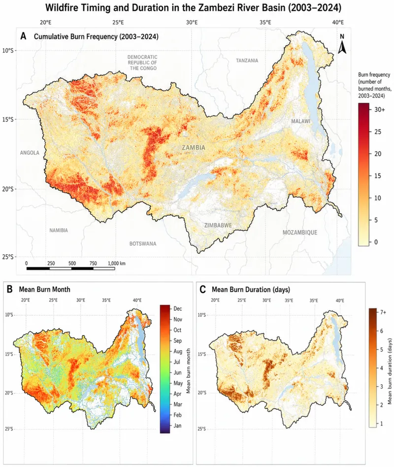
Zambezi River Basin fire characteristics for 2003 to 2024: cumulative burn frequency, mean burn month, and mean burn duration.
Figure 1 from Lutz et al. (2026), CC BY 4.0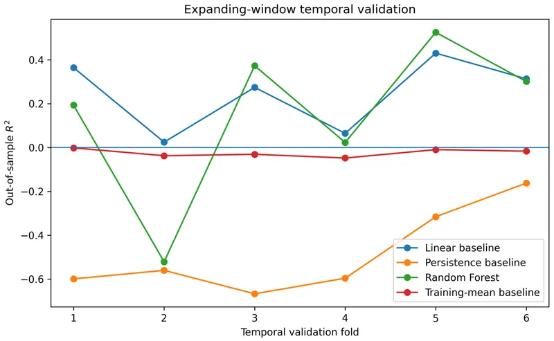
Expanding-window temporal validation of burned-area models: the Random Forest compared with linear, persistence, and training-mean baselines on strictly future holdout blocks.
Figure 2 from Lutz et al. (2026), CC BY 4.0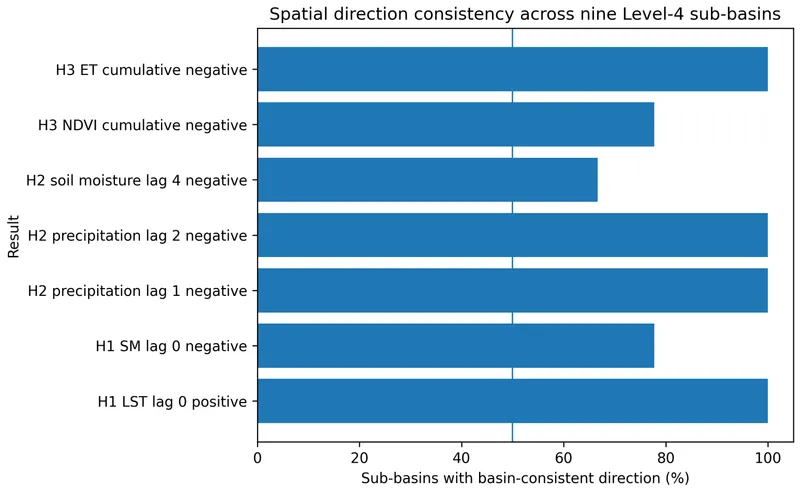
Direction consistency of the primary H1 to H3 results across nine Level-4 HydroBASINS sub-basins.
Figure 7 from Lutz et al. (2026), CC BY 4.0A capstone team project investigating wildfire risk where communities meet fire-prone landscapes.
Research & Environment / AI & Software / Engineering & SystemsInitial data architecture and integration stages validated. Predictive modeling, holdout validation, risk maps, rankings, uncertainty analysis, and a decision-support prototype are planned.
Multisource remote sensing, environmental time-series analysis, regression, distributed-lag analysis, random-forest validation, geospatial processing, and sub-basin robustness testing.
Tools include Python, Google Earth Engine, GIS, MODIS, CHIRPS, and ERA5-Land.
Johns Hopkins Global Hydrology Lab, with paper coauthors H. Lutz, K. Kim, and V. Lakshmi.
UVA Environmental Institute / SE Capstone, investigating wildfire risk and wildland-urban interface decision support as a team.
A proposed research direction on how environmental history shapes wildfire and ecological response.
Research & Environment / AI & Software / Data & AnalyticsA research direction in proposal development. Candidate methods and future analyses are proposed, with no completed results or manuscripts claimed.